Cricket crowds travelling to Edgbaston Stadium in Birmingham are part of new research to help cities identify how and where to cut transport emissions. Matchday travel to the sports ground was used as a real-world scenario to test a new five-step approach to using digital twins to decarbonise transport.
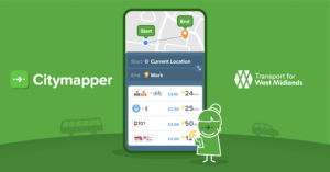
The research, which is published in the journal Urban Science, was led by Durham University and will be used to help develop a prototype passenger transport digital twin of the West Midlands. This will incorporate different transport modes – including buses, trains and cycling – and is being built by TransiT, a UK research hub using digital twins to identify the lowest-cost, least-risky pathways to transport decarbonisation in the UK.
Heather Steele (pictured below), a TransiT researcher and railway systems expert at Durham University, explained:
“Decarbonising transport in cities is complex. Digital twins can help us understand this complexity. But we need to know how planners would practically use them, starting with what real-world scenarios they want to test. Our five-step framework is designed to start bridging that gap, and travel to Edgbaston Stadium is one of the case studies we used to test our approach.”
TransiT is a collaboration of eight universities and almost 70 industry partners, jointly led by Heriot-Watt University and the University of Glasgow and funded by the UK Research and Innovation Engineering and Physical Sciences Research Council, the main funding body for engineering and physical sciences research in the UK.
Up to 25,000 spectators can arrive at Edgbaston on matchdays, and this accounts for up to 80% of total emissions from the event.
Although there are frequent bus services to and from the city centre to the stadium, the location is defined as a ‘transport desert,’ because the stadium is not well connected to other parts of Edgbaston or Birmingham. Railway stations on commuter lines are at least a half-hour walk away. And the neighbouring A38 trunk road can be affected by local road closures on match days.
Applying the new framework, researchers mapped out how a digital twin could support planners by testing transport service changes including:
- Additional shuttle buses or rail‑bus interchange services
- Revised match‑day road access
- Park‑and‑ride options
- Alternative active‑travel routes
- The impacts on local congestion and carbon emissions.
Real-time data sources, like bus occupancy, parking demand and road traffic data, would feed the digital twin with the information needed to make its analyses. Journey planning and real-time information systems could then be used to transmit information from the digital twin back to real-world transport settings, to help influence traveller behaviour.
The researchers describe their five-step approach as a ‘co-created’ framework that was developed in an industry workshop with local authority practitioners, transport planners, modellers and policy specialists.
Participants included experts from engineering consultancy WSP, local transport planners from Transport for West Midlands and Midlands Connect, and researchers from Heriot-Watt University in Edinburgh.
To read the full paper, click HERE.
(Pictures: Warwickshire County Cricket Club; Durham University()