“What’s the address of your emergency?”is the first question that Essex County Fire and Rescue Service control operators ask when someone dials 999. For some people, the answer is simple: a house number, a street name or a postcode. But what happens when the emergency is in the middle of a field? On a country lane? Or deep in woodland with no obvious landmarks?
For the Service’s control team, finding that answer is one of the most important parts of the job.
“When people think about the fire service, says Group Manager Andy Message, Head of Control at Essex County Fire and Rescue Service, they often picture firefighters rushing to emergencies in red fire engines. What many people don’t see is the team behind every single response, the people who answer the call, gather vital information, identify risks, mobilise crews and help guide firefighters to exactly where they’re needed.
“It’s a role that demands calm thinking, quick decision-making and excellent communication, often while someone on the other end of the phone is having one of the worst days of their life.”
One of the biggest challenges, said Message, isn’t mobilising crews. It’s finding the incident.
“This summer has been particularly busy for Essex County Fire and Rescue Service. We’ve attended a growing number of wildfires across the county, many in remote fields, woodland and open countryside. Unlike a house fire, these locations don’t always have a postcode or street name.
“But even when someone can provide an address, finding the right location isn’t always straightforward. Essex has several place names that can sound identical or very similar. For example, we have both Kelvedon and Kelvedon Hatch, as well as two separate villages called Debden, each in different parts of the county.
“For someone calling 999 in a stressful situation, a place name alone may not always be enough to immediately identify where help is needed,” he continued. “Our Control operators use a combination of information from callers, mapping technology and their own expertise to make sure crews are sent to the right place. We’ve even had callers describe incidents as “near the big tree”, “next to a farm” or “at the end of a country lane”. Unfortunately, that could potentially leave us searching across hundreds of acres. Every minute spent trying to pinpoint a location is a minute we’re not tackling the fire.”

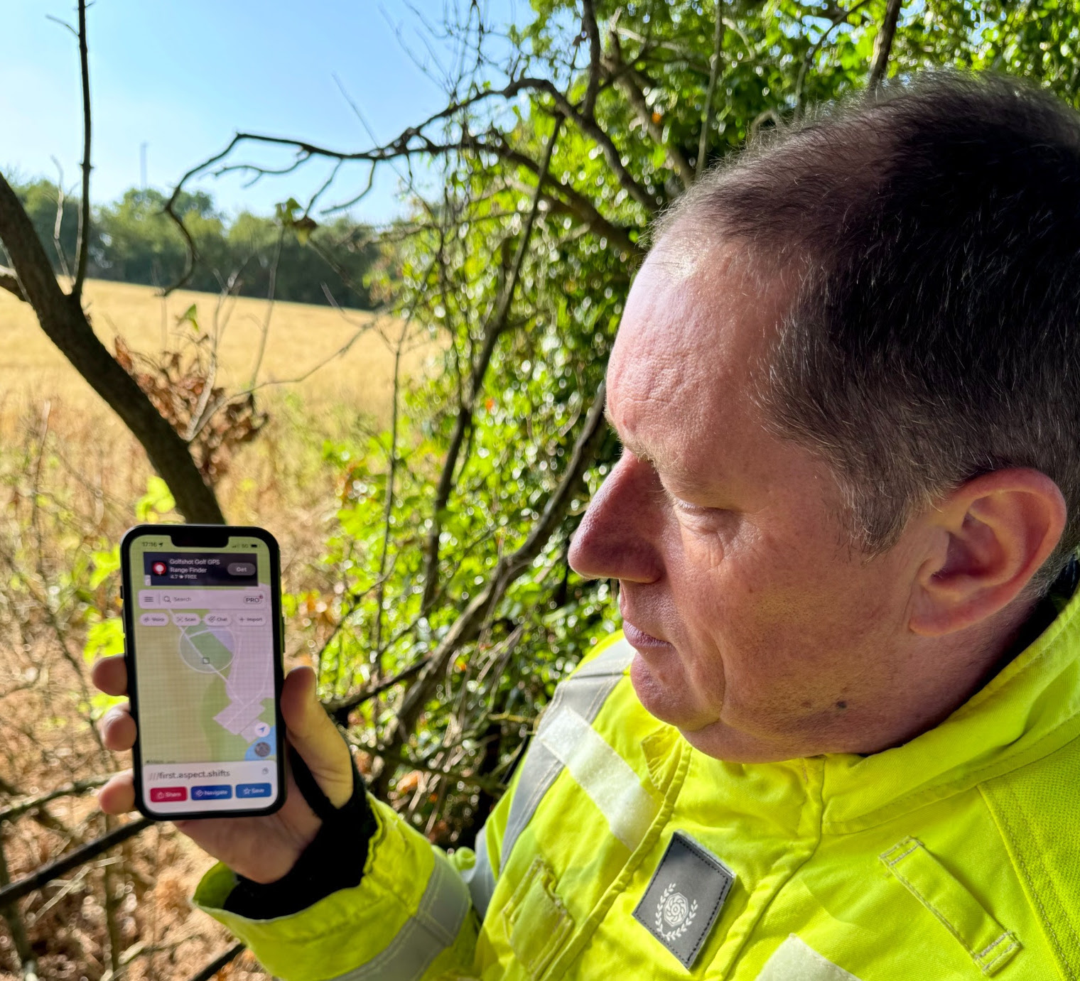
To help with the accurate location of incidents, Essex County Fire and Rescue Service are actively encouraging Essex residents to download the free what3words app, which divides the world into three-metre squares, each with a unique combination of three words.
“Instead of trying to explain where an incident has occurred, you can simply tell our Control team those three words and we’ll know exactly where to send firefighters. It removes uncertainty and helps us get help moving more quickly,” Message explained.
“Of course, wildfires aren’t the only emergencies where this matters. We use what3words for road traffic collisions on rural roads, water rescues, people trapped in remote locations and many other incidents where giving directions can be difficult.
“As the weather remains hot and dry, we’re also asking everyone to think carefully before lighting anything outdoors. Please leave bonfires for another day, don’t use disposable barbecues or campfires in the countryside, and report fires as soon as it’s safe to do so. But we’d also ask you to take one simple step today: download what3words before you ever need it. Hopefully you’ll never have to use it.”
(Picture: Essex County Fire & Rescue Service)