A new report detailing the actions taken by the Council and other responsible bodies during flooding in Reading this January, and recommended actions to tackle future flood threats, has been published.
Three months of extremely wet weather followed by intense rainfall on saturated ground during Storm Henk led to 24 properties being flooded in Reading in January.
Sixty-five percent of the total recorded rainfall for the month fell in the first four days of the year, with 38% of January’s total falling within a 12-hour period.
The January 2024 Flood Event Options Report, compiled by independent specialists Stantec, is being presented to members of the Council’s Policy Committee on Monday 8 July. It sets out the actions taken to prevent flood risk by the Council, which shares responsibilities with other agencies for Reading’s waterways, including the Environment Agency, Canals and Rivers Trust and Thames Water, and recommends future actions.
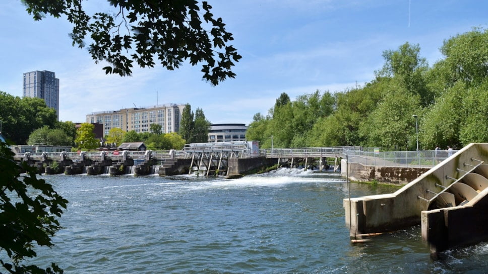
The report says that heavy rainfall during Storm Henk led the River Thames at Reading to reach its highest recorded levels since the major floods of 1947. Flooding also arose from the River Kennet, Holy Brook and their associated ditches and tributaries.
Twenty-one homes and three commercial properties were flooded in Reading at the time, including one static caravan.
A major incident was declared by the Council and emergency services on 5 January. Public Health, Social Services and Education departments activated their vulnerable person action plans and Council staff delivered sandbags to households in parts of Southcote and Lower Caversham, and visited reported flooding sites along the Thames, including Scours Lane.
The Council commissioned clearance works to the Christchurch Ditch in Caversham, and a ditch south of Circuit Lane, and carried out repairs to the Kennet bank which was damaged by flood water. They also installed a temporary clay bund under Briscoe’s Bridge to hold back flood water from Circuit Lane.
Residents affected by the floods were invited to share their views and experiences with the Council, Stantec and the Environment Agency at a meeting in early February.
Several actions for the areas affected by flooding are being recommended for the Council and other responsible bodies.
In Lower Caversham, this includes investigating the state of repair and capacity of Christchurch Ditch, establishing if repairs are required to a footbridge at the eastern end of Hills Meadow, the need for a trash screen to capture debris before it enters the ditch and the establishment of a checking/maintenance schedule at the site.
Proposed actions in the Southcote/Kennet Meadows area includes investigating the potential for permanently raising the access road level under Briscoe’s Bridge, looking at the need for regular ditch and culvert clearance, installing a level gauge in the Holy Brook to show water levels and to explore the potential for ‘re-wetting’ Kennet Meadows.
The Council also carried out an exercise to learn from the flooding event and to put measures in place to better respond to the next flood emergency, including annual reviews of flood action plans and providing residents with a clear route to contacting the Council if assistance is required.
Chris Wheeler, Assistant Director of Environmental and Commercial Services, said: “It is a devastating experience for any householder or business owner who suffers flooding of their properties.
“The months of heavier than normal rainfall followed by the downpours caused by Storm Henk resulted in a rapid rise in river levels and the flooding of 24 properties in Reading, with many other residents concerned.
“With flooding events expected to be more regular due to climate change, it is vital that residents know how to stay alert and to be prepared for flood threats, and that the Council and other responsible bodies have robust plans in place.
“Experience and learning from the floods in January will help the Council and its partner agencies to take further measures to help reduce the risk of flooding and to work effectively together at any future flooding emergencies.”
The Policy committee report and January 2024 Flood Event Options Report can be found at:
https://democracy.reading.gov.uk/ieListDocuments.aspx?CId=138&MId=5417
pic-READING BC