
Lincolnshire Resilience Forum prepares for emergencies with digital twins and drones
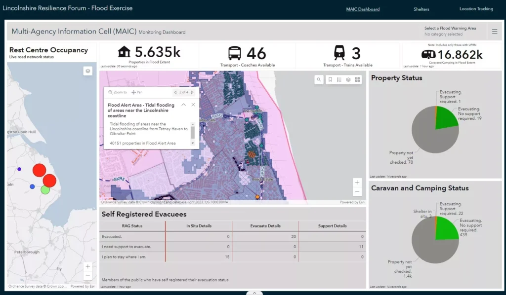
Lincolnshire Resilience Forum (LRF) has gone live with new geospatial and drone technology from Esri UK to help it better prepare for emergencies across the county, including flooding, loss of critical infrastructure, pandemics or severe weather. Image recognition and drone software are among new applications helping to create real-time intelligence and an improved understanding of […]