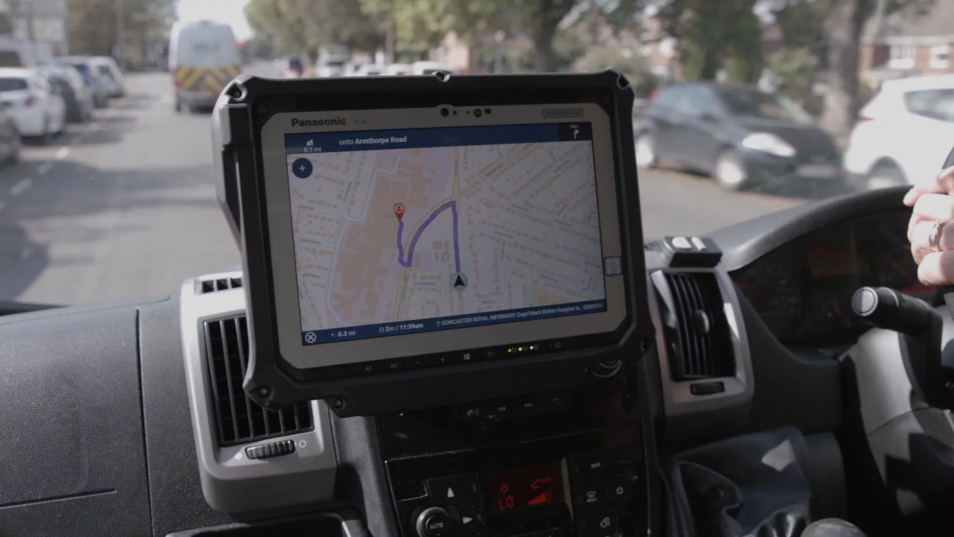
A new in-cab navigation application, underpinned by Ordnance Survey mapping, will be rolled out across all Ambulance Trusts in the country with the aim of improving patient care and at-scene response times.
The Ambulance Radio Programme was established by the Association of Ambulance Chief Executives and the Department of Health and Social Care to deliver critical technological system improvements, providing enhanced communications between Ambulance Trusts, the NHS and other emergency responders.
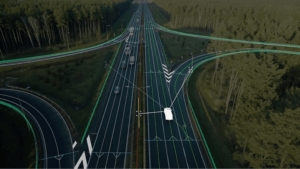
To do this ARP has funded a new and improved mobile data system called the National Mobilisation Application (NMA), which has been developed in collaboration with mobile data experts Terrafix and delivers the most up-to-date and detailed mapping of Britain’s rural and urban areas including highly accurate road and addressing information. DHSC contracted Terrafix via their Public Sector Geospatial Agreement (PGSA) licence to build the application on behalf of ambulance services.

Crucially, the PSGA licence enabled Terrafix to integrate OS addressing, roads and mapping products such as OS Zoomstack, OS MasterMap Highways Network and AddressBase Plus into the NMA, therefore, bringing navigation in line with the same OS datasets in every NHS computer aided dispatch (CAD) system used in emergency control rooms across the country.
Not only does this mean that all NHS services will be accessing and using the same and most authoritative addressing and mapping data in Great Britain, but ambulances no longer need to be taken off the road to download the latest mapping and navigation data. The new service no longer requires manual data uploads as mapping updates can now be streamed to the in-cab technology using designated Wi-Fi hubs at key operational sites.
Yorkshire Ambulance Service (YAS) NHS Trust has recently gone live with the service and is now commencing a roll-out across the fleet of over 650 ambulances and rapid response vehicles.
Simon Marsh, chief information officer at YAS NHS Trust and project sponsor said: “YAS is proud to be the first to implement the new solution into our ambulance and rapid response vehicle fleet. Having access to accurate and up-to-date mapping is essential to all the emergency services, and with ambulances it can make all the difference to our patient care and response times through improved navigation.”
(Picture – Ordnance Survey)