Highway authorities tell of benefits of moving to high definition, image based condition surveys to get a more accurate insight into the state of their network, while the future will be about providing this data in real-time to view any time, from anywhere.
Using imaged based road condition surveys has helped local highway authorities have a more detailed and accurate insight into the exact condition of their road network as well as provide a platform for more knowledgeable lifecycle modelling and helping provide solid evidence for future funding.
These are the combined thoughts of several local highway authorities who have chosen to work with highways technology specialist Gaist, to help them deliver a more effective and efficient highway service.

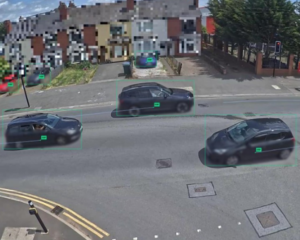
Many of the highway authorities that were interviewed talked about the challenge of using other surveying systems such as SCANNER, which has been returning inconsistent and unreliable data.
Previously, SCANNER was the only option available to councils until the DfT acknowledged other surveying methods to be used alongside SCANNER following the emergence and consistently high development of alternatives such as Gaist’s imaged based surveying. But by moving to the Gaist system which can monitor and measure road condition using camera imaging systems backed up by machine learning software, those authorities who have used it have reported significant improvements but have not necessarily spent any more of their budgets.
The City of Bradford Council approached Gaist because it wanted to take its data collection ‘to another level’. “We wanted something that was more user-friendly and visual from which we could harvest more detailed accurate data, including gully information, which had previously been limited, but also highlight and articulate to others what we had achieved and what we wanted to achieve moving forward,” says Andy Fisher, Principal Engineer – Highway Maintenance (North) at Bradford
Council.
In the end, they opted to work with Gaist and use its HighwayView and AssetStream products. “Gaist HighwayView is a web-based product and their method of analysis and video-capture was very appealing to us at that time. The level of detail provided by this system is very impressive and better than anything else I have seen,” says Mr Fisher.
“The results from the first year of surveys were very impressive and they delivered exactly what we were looking for. In AssetStream, everything was set out at a level of detail we never had previously, including the gullies. All the roads and footways are condition-graded and for me personally, one of the biggest benefits is the ease of assessing the condition of each roads. In turn, this makes it much easier to explain to some of our stakeholders,” says Mr Fisher.
A significant objective for Dorset CC as part of developing its highways management and performance plan is to improve the quality of road condition data. Initially Dorset worked with Gaist and other companies to trial a survey on the unclassified part of the network, using Gaist’s high
definition cameras. Straight away, it was noted that the cameras were able to fill in a knowledge gap by giving detailed information on the condition of the county’s minor roads and roundabouts which are not surveyed by SCANNER.
“We have been using SCANNER for a long-time now but have been challenging some of the outputs we have been receiving from the data,” says Michael Hansford, Dorset CC’s Highway Asset Manager.
“There are examples of the data telling me that we had significant problems on roads that weren’t that old, and when this data was used to generate schemes, this began to create trust issues between us and our designers who were also questioning the data. This meant there was a much
higher scrutiny of the data in general and we also noticed problems with texture, and it throwing up a lot more false negatives around cracking that wasn’t necessarily there but it was simply debris that was registering that on the system. All this really led to us de-valuing the data that we had,” he adds.
Councils are also finding the Gaist services useful across different services. The London Borough of Southwark’s highway team found that cross-working with its traffic management and parking teams has helped with efficiency drives and the better understanding of other council services.
“The Gaist data is also helping us understand what we need to do as part of our white-lining refreshment programme. It means we can pool our resources and budgets to be more efficient operationally across the different parts of the networks and across different teams that work on it.
The Gaist survey and systems have worked out nearly two-thirds cheaper than anything else we have done in the past, yet we get more detailed and accurate data and more efficiency, ” according to Graeme Lake, Asset and Technical Manager at Southwark Council.
Speaking to Highways magazine earlier this year, Shaun Taylor, Highway Maintenance Manager at Bristol City Council, says he now uses Gaist to survey all the network.
He said: “It took two or three weeks to survey the network in July 2018, to inform a repairs and asset management programme based on where the data suggested we had defects. We then sent experienced engineers to see if these were the right places and we had a 100% success rate. We never went to somewhere that didn’t need a repair. We also had engineers colour code the network and compare it with the data from Gaist and it was almost identical. This gives us a real opportunity to get the best value for money. I don’t use SCANNER now, I am using Gaist for all the network.”
The benefits are pronounced though. Mr Taylor says he now has ‘full confidence in lifecycle modelling’ and in the figures around his maintenance backlog and funded asset management system, and all this at a ‘similar cost to SCANNER’.
Andy Bithell, Network Management Commissioner, Cheshire West and Chester Council, another Gaist customer said: “Comparing SCANNER data with other surveys was very challenging and was giving us different conclusions, meaning we were never completely sure of the real condition of the complete network; we soon realised that we needed a higher level of detail and accuracy.” Added to this, the Council also allocated resource on a detailed DVI survey.
“We began to realise that this level of detail combined with other data sets could help create more information on an individual street which could then inform investment decisions and support our
holistic approach,” added Mr Bithell.
In 2019, Gaist surveyed the entire network including footways which is the first time the Council has had this data for the whole network. Mr Bithell explained: “After processing the first-years’ data we were able to obtain polygons that break down the network into individual schemes which provided detailed total network coverage that we were looking for. This meant we were able to integrate that with other data sets such as pothole/defect history or accident claims data, for example.
Gaist is already thinking about the future. “The future will be about using real-time data of the network to show a detailed, accurate and up-to-date view of the condition that will be available to
view on-line at any time,” says Steve Birdsall, Chief Executive of Gaist. “What we are continually trying to drive is quality, accurate and detailed data that can be delivered on demand not only for those involved in highways but for a wider group of stakeholders that want data on the wider
environment.”
To read all the Gaist case studies in detail, please go to: