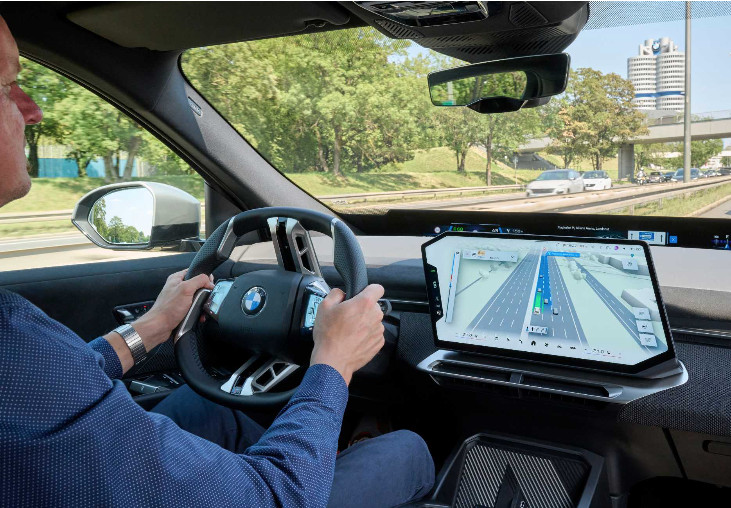
BMW is to introduce a new navigation feature combining route guidance, vehicle surroundings and driver assistance information in a single 3D display from November 2026.
BMW Maps with Driver Assistance will be available on vehicles equipped with BMW Operating System X, giving drivers a clearer view of their position on the road and how assistance systems are responding to the driving environment.
The display shows the vehicle’s position within its lane and at the correct road level, helping drivers navigate motorways, junctions and urban traffic while understanding which assistance functions are active.

The system will also integrate with BMW’s Highway Assistant, which supports hands-free driving on motorways at speeds of up to 85mph. The system controls speed and steering and can carry out automated lane changes following driver confirmation with a glance.
When route guidance is active, Highway Assistant can support the journey from the motorway entrance to the exit.
BMW said the technology had been developed in collaboration with mapping specialist Mapbox, bringing navigation and environmental perception together to improve driver orientation when assistance systems are in use.
The launch is part of BMW’s ongoing development of connected vehicle technology and systems designed to support increasingly automated driving.
(Picture: BMW Group)