The provision of high quality roadscape data is set to take a significant step forward with a nationwide roll-out of digital mapping services by Gaist, the highways technology leader.
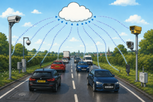
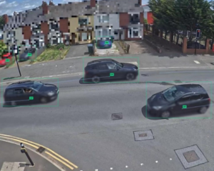
Using 360 degree camera surveys, Gaist will now capture and curate the most up-to-date and highest-definition roadscape datasets in the UK. Covering all ABC and unclassified roads – a total 400,000km – the national data layer will be refreshed at least annually with cities refreshed monthly.
Andrew Loveless, Gaist’s Commercial Director, said: “After seeing the evolution of road mapping, we decided now was the right time to develop a range of national HD road services including base maps, national imagery, change intelligence and analytical ready data in order to respond to the growing needs of both public and private markets. Analysis from 2018 suggests that more accessible and better quality location data in infrastructure and construction could be worth over £4 billion per year.”

This latest development comes amid a surge in demand for accurate, detailed and fresh data about the UK’s highways and road-side assets and infrastructure to support the creation of ‘digital-twins’.
Gaist said demand is being driven by developments including the roll-out of 5G, which is seeing telecoms operators step-up investment in their networks and the introduction of connected autonomous vehicles (CAVs) which rely on machine-readable digital maps or ‘splines’ to operate. The market for maps for CAVs is predicted to grow to $24.5bn by 2050.
The proposed re-working of road layouts and the extension of nationwide cycle schemes in response to Covid-19 will also require detailed intelligence about the existing roadscape – details ranging from the quality of white line markings to the exact position, configuration and condition of telegraph poles and street lights.
While roads data at a national level is available, the pace of technological change and increasing market demand has made it more challenging for existing suppliers to meet the demand for increased resolution and improved currency cadence which is critical to drive the economy forward, said Gaist.
Many have focused on ‘high value areas’ including major cities – while data on more rural areas may be less frequently refreshed. This can leave uncertainty over its accuracy, the company added.
Gaist’s scale-up follows more than a decade of successful operations at a regional level in the UK and internationally.
The company’s regional work and over two peta-bytes of data has also enabled it to refine its capture techniques and its application of technologies, including, AI and machine learning to accelerate the pace at which it is able to provide organisations with access to the rich, quality-assured intelligence they need.
In its recent Geospatial Strategy, the Geospatial Commission made clear its focus on unlocking the value of location data through clearly defined processes, targeted investments and the provision of better access to data.