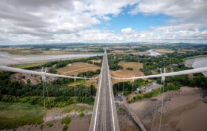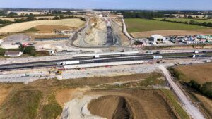
National Highways has developed a new flight management system to make it easier to plan the use of drones for monitoring and surveying near its assets across the country.
The Drone Cloud developed flight management system was launched earlier this month. Its aim is to speed up the process for drone operators looking to fly near National Highways’ motorways and major A roads.
The system is designed to improve safety through better coordination and visibility of flights. The information is also shared with organisations such as Network Rail, National Grid and other large companies using the system to help prevent conflict with any other flights taking place nearby.

Drone operators looking to fly near National Highways’ assets will be able to go online to enter details of their planned flights. They will then be able to see if other flights and operations are planned in the area and when.
National Highways drones governance hub chair Jason Glasson said: “Drones are already used for monitoring construction projects, as well as surveying and inspecting assets.
“Drones allow the industry to gather new and richer asset information while minimising risks to workers and road users. They also reduce disruption for drivers as few road closures are required for these activities.
“With usage increasing, we needed to develop a more joined-up approach to appropriately coordinate drone activities near our network.”

Currently, drone operators from the supply chain and contractors have to contact National Highways to supply the necessary paperwork, including risk assessments, and then have their request accepted. They then notify National Highways ahead of any flights, and the business carries out checks to ensure there are no conflicts.
In the last two years there have been more than 1,000 notifications with the number of flights increasing.
Under the new system, operators will be able to go online to record their flight details and to find out whether that will cause conflict with other aircraft. In addition, there will now be details of flights booked with other organisations such as Network Rail.
The system works alongside a new drone standard, GG 954 – Drones operations, which contains requirements over and above those defined by the regulator, the Civil Aviation Authority.
National Highways’ company-wide GG 104 standard is also meant to ensure that the use of drones is safer, or at least as safe as, the existing way of undertaking surveying, construction or asset inspection.
“Our safety risk governance approach for all drone operations, supported by this new flight management system, will help us safely plan, coordinate and record our increasing drone operations, while maintaining safety for our workforce and people living near to the road network,” Glasson added.