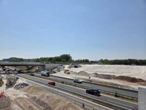
NEVFMA is the UK’s first fully operational, county-wide predictive model for the Highways England strategic road network in Oxfordshire. The model predicts not only traffic but also emissions, with a real-time, traffic-linked pollution dispersion model. As Aimsun’s UK Managing Director Gav Jackman explains, this delivery uses a large-scale model of the county of Oxfordshire that is connected in real-time to ITS systems and uses traffic simulation to produce responses which reduce congestion and harmful, traffic-related emissions.
More details about this project will be given at the JCT Traffic Signals Symposium in Nottingham, which takes place on 15 and 16 September.
The model was delivered for the Network Emissions/Vehicle Flow Management Adjustment (NEVFMA) project, funded by Highways England and delivered by Aimsun in partnership with EarthSense, Siemens Mobility and Oxfordshire County Council. NEVFMA uses the Aimsun Live solution to generate short-term predictions for traffic and nitrogen dioxide (NO2) dispersion to help traffic centre operators make the most effective traffic management decisions.

Initial Analysis at the end of 2019 saw that of the 57% of the days evaluated, emissions exceeded the annual legal average. On 65% of the days evaluated, the system recommended a different traffic management strategy than a do-nothing scenario, to bring Emissions back in line, and on those occasions, emissions were predicted to be on average 5% lower if a chosen strategy was deployed.
The NEVFMA project integrated elements to bridge the gap between current generation and next generation traffic management. The end goal of the project was to prove that linking the technology is useful in improving network understanding and decision support, allowing traffic operators to holistically balance their road network. By giving operators insights into which traffic management strategies to deploy, the system can help improve network capacity and air quality across regional and strategic networks. Several first of its kind innovations were delivered.
This is the UK’s first (and only) county-wide real time traffic simulation. It integrates an air quality dispersion model with the traffic model in real time which provides a new level of visibility, knowledge and learning about the road network and the impacts of traffic. The original intention was to use existing traffic management response plans from Highways England and Oxfordshire County Council (OCC), however no such plans existed. Aimsun investigated, modelled and developed a library of traffic management response plans, using Aimsun Next’s inbuilt emissions model.
The concept
The NEVFMA project extended and expanded traditional simulation with the key focus of short-term traffic and air quality predictions obtained by combining real-time analysis of monitoring points with simulation. It also provided monitoring of the network in near real-time; continuous network traffic data updated the visualisation platform, providing early alerts via key performance indicators (KPI) for traffic management and non-recurrent situations. Key to the solution is to holistically look over both local roads and the strategic road network.
The Solution
Aimsun Live is suitable for aiding traffic management centres and operators by assisting in answering the questions:
- Is there any anomaly in the current traffic conditions that may indicate an incident?
- How will traffic change within the next hour?
- What would be the impact of this traffic management action?
- Which response plan should I activate? Aimsun live, integrated with a reactive MappAir model provides significant additional benefits:
- Does my region exceed / have an air quality breach?
- What types of proactive traffic management can prevent a breach?
- What types of reactive traffic management can help fix a breach?
- Based on mean NO2, which plans offer best results in key metric regions? Traffic model The simulation compromises two parts; Aimsun Next and Aimsun Live. These work together to simulate and predict highway assignment trips, such as car, van, truck and bus. Other modes of transport are not represented such as rail, cycle or pedestrians.
• Aimsun Next
Aimsun developed, calibrated and validated a 2019-2020 operational traffic model in Aimsun Next for the Oxfordshire region including typical day patterns for 24hrs and 10 different day types. Restrictions to limit the spread of Covid-19 were in effect during the project, so one pattern was developed to monitor their impact. The model included up to date signal timings, public transport timetables and added detail to the imported Oxford Strategic Model, such as curvature, lane detail and individual vehicle behaviour.
• Aimsun Live
Aimsun Live is a real time modelling platform, which allows traffic operators to predict future traffic conditions and to evaluate the impact of traffic management strategies quickly and objectively. Real- time simulation has the potential to significantly improve the accuracy and relevance of traffic forecast, as it considers capacity changes and network effects. The online Aimsun Live environment matches the coverage the offline road network developed using Aimsun Next.
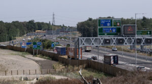
To turn the Offline base model into an Aimsun Live real-time predictive and decision support system, Aimsun reused existing authority infrastructure, including connecting to three real-time data sources,
comprising 179 traffic flow monitoring sites. The continual updating of traffic flow in the model uses live data feeds rather than collected data. The multiple real-time feeds unite data from different organisations – in this case, Cloud Amber Ltd, Vivacity and Highways England, and together simulate truly dynamic traffic flows within a few minutes.
Air quality monitoring and dispersion model
The only new ITS assets deployed were 18 new Zephyr air quality monitoring sites. EarthSense used data from these, including an integrated Zephyr, designed and installed on existing low voltage sites by Siemens and other sources to develop an air dispersion model that integrates with Aimsun Live
Aimsun Live uses the London Emissions Model to predict pollutants on the network over the next hour, for four alternative model scenarios, before EarthSense undertakes dispersion modelling by applying NOx partitioning, background and meteorological effects to the prediction. Regions are monitored in the model with KPIs indicating which response plan from the alternative scenarios can increase or lower the local NO2 pollutants.
Aimsun Live’s inbuilt emissions model and advanced mesoscopic computations mean that individual road section pollutants for a mixed traffic fleet can be predicted for the next hour in a couple of minutes, across the whole network.
This speed, adaptability and flexibility are essential as NEVFMA has proved beyond any doubt that emissions and traffic are not static, even across the course of a single day: one solution does not fit all. Every day is different and each traffic scenario requires a different response plan.
Microsoft Word – NEVFMA JCT paper final.docx
EarthSense were contracted to deliver an air quality dispersion model using MappAir software. First the pollutant data (NO2) recorded from the deployed Zephyrs was made available to the project team via EarthSense API. Future pollution (NO2) dispersal predictions were made available using the API.
The EarthSense MappAir model uses advanced modelling techniques to produce high resolution, near- real time maps of pollution. The standard MappAir product was updated and optimised for the NEVFMA project to provide the following additional functionality:
- 10m resolution modelling outputs for Oxford
- Air quality and meteorological forecasts to allow the model to output data for the future scenarios (+15, 30, 45 and 60 minutes)
- Highly optimised and multi-threaded version produced to be able to handle multiple scenarios in the specified time
- Updated to ingest live traffic data
- Updated to run in a reactive mode based on data received from Aimsun
- Pollutant outputs – NOX vs NO2
Response Plan generation
OCC recognised climate action as a top priority and transportation is the top individual contributor to emissions. To date they have embarked on several ground-breaking initiatives to reduce emissions in Oxford e.g. Connecting Oxford and introducing a Zero Emission Zone.
Highways England has a legal obligation to improve the AQMA to the south of Botley on the A34. A key goal for the NEVFMA project was to develop improvements in this area, which exceeds the 40 μg/m3 NO2 annual average limit.
Response plans are designed to tackle events such as congestion or in the case of NEVFMA, NO2 exceedance. In Aimsun Live, a response plan is made by including individual strategies to make up the whole response plan. These policies include:
- lane or turn closure
- speed change
- forced turn or forced route
- destination change
- control plan change As no response plans existed to mitigate against emissions based on air quality data, an exercise was undertaken to design, model, test, evaluate and select those that showed to be most promising, using the offline Aimsun Next Model. Those chosen were then deployed in Aimsun Live.
Results
The ability to choose different response plans on different days, (or times) shows the true benefit of the dynamic real-time decision support system. If response plan 1 offered 10% benefit for 50% of the days and response plan 2 offered 10% benefit for the other 50% of the days, the annual average would see an excellent benefit if both were chosen when forecast.
The problem is dynamic and fluid, and in this short analysis of results, only region 13 was considered as the focus, as it has Highways England’s AQMA. Overall, as may be expected with a dynamics network, different RP should be called on different days depending on the traffic, weather and atmospheric conditions.
Summary and Conclusions
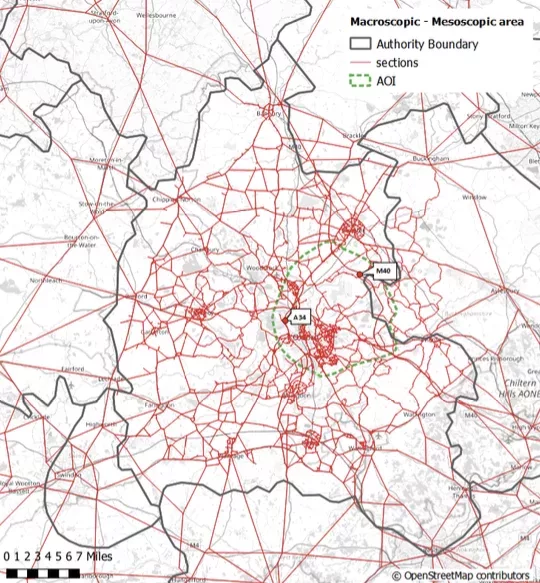
The Network Emissions / Vehicle Flow Management Adjustment (NEVFMA) was an SBRI proof of concept project awarded by innovate UK, on behalf of Highways England, to a consortium of EarthSense, Siemens and OCC, led by Aimsun. The project had a geographical coverage of Oxfordshire, with an area of interest covering Highways England’s strategic road network, the A34, including the M40 junctions 8 and 9.
The aim of the project was to integrate emerging technology to holistically balance strategies to enhance public spaces with strategies aimed at improving network capacity (increasing vehicle flow), to deliver better air quality across regional and strategic networks.
The goals of the NEVFMA project were to:
- Use modelling to estimate the impact of traffic on air quality, using traffic data provided by the local authority, an emissions and dispersion model and benchmark this model with ground truth measurement from state of art AQ monitoring devices installed in both vehicle and infrastructure;
- Prototype the integration of AQ sensors to standard infrastructure used by highways authorities (traffic lights and streetlights) and;
- Create short term and medium-term predictions (up to 1 hour) for the AQ in the regions and establish tactics that control centres can deploy and model their implications, establishing KPIs that highways authorities and traffic management centres can use to evaluate the effectiveness of AQ-aimed interventions.
- Prove that Artificial Intelligence can predict MOVA optimisation. (not part of this paper of the presentation at JCT Symposium). More information can be obtained from the author or Gary Bray at Siemens. The NEVFMA project successfully met these goals which enable local government and roads authorities to balance strategies in real time. The best performing response plan for the A34 was response plan 5, which gave a NOx reduction of 4% in regions 3 and 13 which cover the A34. The best performing response plan for Botley Road was response plan 6, which gave a NOx reduction of 14% in region 9 which covers Botley Road. Due to the ongoing impact of Covid-19, the OCC highways team were unable code the developed test response plans into UTMC. To counter this, the best comparative testing that could be provided was in the form of analysis of predictions and ground truth where possible. In line with Highways England’s aspirations for the project, region 13 was monitored in these tests by averaging traffic detection points on the A34 and Botley Road. Zephyr 64 was nearest and used for air quality ground truth.
Over the test period, an hourly mean threshold of >40 μg/m3 NO2 was exceeded:
- 59% of mornings,
- 55% of evenings.
This analysis alone demonstrates the need and value of having a proactive system such as NEVFMA advising on response plans to mitigate against the exceedance. The system was performing well, reacting well to traffic and generating good predictions particularly in the morning, demonstrating the system could provide reliable short-term predictions and that there was good reason to deploy, as every day different response plans could help in different ways, depending on traffic and meteorological conditions. While short, the trial period showed that all response plans were generated taking account of 2019 average conditions, employing the right response plan could give up to 7-8% benefit, while the wrong response plan could cost a 14-15% disbenefit – but right and wrong being entirely dependent on day conditions. In 18 trialled days, the response plans could make a modelled improvement between 65% (morning peak) and 54% (evening peak).
Further data has been analysed from April since UK traffic bounced back with lock down easing, and further data will be analysed during the summer in time for the the Symposium.
(Graphics courtesy of Aimsun)