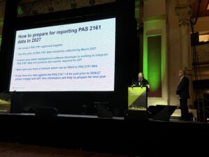
Changes to the way the Department for Transport measures road lengths could reduce the recorded length of England’s minor road network by around six per cent, according to preliminary findings presented at LCRIG’s Strictly Highways conference in Blackpool.
Dr Elizabeth Wloch, Road Length Statistics Lead at the Department for Transport, told delegates that the proposed methodology would improve data quality, reduce reporting burdens on local authorities and provide a more detailed picture of the publicly maintained network.
The changes concern how road lengths are recorded, rather than a physical reduction in the network. Dr Wloch stressed that the results were preliminary, with the methodology still being finalised.
The proposals would replace the periodic local authority road length return with Ordnance Survey data as the sole source for the statistics. Local authorities would continue to contribute through information supplied to the National Street Gazetteer, which feeds into Ordnance Survey’s products.
Dr Wloch highlighted the significance of accurate figures for councils, telling delegates that road length currently accounts for about 80% of highways funding and is also required in their transparency reports.
“First of all, we just want to improve the data quality,” she said. “With our new methodology now, we can say exactly which roads are in and which roads are out of any of our datasets.”
Preliminary comparisons suggest most English local authorities would see a reduction in their recorded minor road lengths, covering B roads, C roads and unclassified roads. The average reduction across the country was around 6%, although the percentage change varied between authorities.
DfT has held targeted discussions with authorities showing the largest changes, using maps to help examine the differences. Dr Wloch said a number of councils had reported that the new figures matched their own internal records more closely than the existing published statistics.
For locally managed major roads, the preliminary results generally showed an increase in recorded length. This comparison excluded trunk roads and the strategic road network.
Some differences arise from the more precise allocation of roads along local authority boundaries. Where an entire road might previously have been assigned to one authority, the new approach can divide its length between neighbouring authorities according to the road’s position relative to the boundary.
The methodology would also apply the same measurement rules centrally across the country and allow separate estimates for C roads and unclassified roads to be produced annually.
DfT plans to introduce the methodology in its Road lengths in Great Britain 2026 publication, due in spring 2027. An accompanying paper will compare the old and new figures.
Dr Wloch said engagement with local authorities would continue alongside work with Ordnance Survey and GeoPlace. She urged councils to maintain accurate National Street Gazetteer records and work closely with their gazetteer custodians.
“Make sure it is the most accurate reflection of your local authority’s network, so that we can then use the best data that we have available,” she said.
(File picture – Oxfordshire)