Jonathan Selbie is a former Formula 1 engineer at Red Bull Racing who has developed a highly innovative solution to the UK’s growing pothole conundrum. Via careers in aerospace and autonomous systems he now runs Univrses, a Stockholm-based deep tech company that uses AI to fundamentally change how roads are monitored and maintained. The BBC’s Tech Life programme recently labelled him the ‘AI Pothole Hunter’.
In this opinion piece written exclusively for Highways News, Jonathan explains how AI is transforming road maintenance and why the shift from reactive to proactive will save authorities enormous amounts of money, and why our roads aren’t ready for autonomous vehicles and what needs to change before they are.
My career has largely been shaped by environments where data is fundamental to performance. In Formula 1, virtually every aspect of performance is measured and analysed, with those insights informing decisions across the organisation. The quality of the data has a direct bearing on the quality of the decisions that follow. When I moved into autonomous drone systems, the context changed, but the underlying principle remained much the same: accurate, timely data was essential, particularly in an environment with a very low tolerance for error.
Both fields demonstrated what can be achieved when sophisticated technology and rigorous use of data are applied to complex problems. They also prompted a broader question: where could the same principles be applied to challenges with a much wider impact?
That question eventually led me to Univrses and, perhaps unexpectedly, to roads. Road networks are fundamental pieces of infrastructure, used by billions of people and underpinning much of our everyday economic and social activity. Yet the methods used to understand their condition can be surprisingly traditional. Where a racing team might continuously collect and analyse data to understand the performance of a car, many road authorities still depend heavily on periodic manual inspections to understand the condition of their networks.
The consequence is an information gap. Defects can develop between inspections, and by the time they are addressed, they may have deteriorated further, increasing both the cost of remediation and the potential risk to road users.
The challenge is not simply one of willingness or investment in road maintenance. It is also about making better technology cost-effective and practical to adopt. An authority cannot address a defect it does not know exists, and without frequent, comprehensive data, it is difficult to build an accurate picture of the condition of an entire road network.

At first glance, solving that problem might appear to require significant new infrastructure: dedicated survey vehicles, specialised sensor arrays and complex deployments. But much of the infrastructure needed to collect the underlying data is already moving through our cities every day.
Municipal vehicles, buses, taxis and other fleets routinely travel across large parts of the road network. By equipping existing vehicles with cameras, it becomes possible to collect road-condition data as part of journeys that are already taking place. Rather than creating a new fleet specifically to survey roads, existing fleets can become part of the sensing infrastructure.
Collecting imagery, however, is only part of the challenge. The greater technical difficulty lies in turning it into information that road authorities can reliably use. Computer vision models must be able to identify, classify and locate road defects with a high degree of consistency and accuracy. My experience in Formula 1 and autonomous systems shaped my approach to that problem at Univrses: data is only valuable if there is sufficient confidence in the information derived from it.
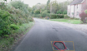
Univrses’ answer to this challenge – our 3DAITM product suite – works by fitting cameras to vehicles already operating in a city which continuously photograph road conditions as they go about their normal routes. That imagery is then processed using computer vision models that can identify and classify a wide range of road defects, from surface cracks and potholes to damaged signage, and plot them precisely on a map. The result is a continuously updated, network-scale picture of highway conditions that authorities can access in near real-time, rather than waiting for the next annual survey.
The computer vision technology underpinning Univrses’ road monitoring platform has its origins in our work with leading automotive OEMs. We have developed software components used in production vehicles, including the Polestar 3 and Volvo EX90, to help vehicles interpret and understand their surroundings. We continue to work with a number of OEMs on technologies supporting advanced driver assistance systems.
Increasingly, however, the way in which we work with automotive customers extends beyond the software within the vehicle to the data that connected vehicles can generate. As vehicle sensor suites become more sophisticated, the information they can provide about the surrounding road environment becomes richer, more precise and potentially more valuable.
This represents an important shift in the potential scale of road monitoring. Today, data can be collected through cameras installed on selected commercial and municipal fleets. In the future, connected passenger vehicles will provide observations at a vastly greater scale, creating a continuously evolving picture of road conditions across entire networks. The result is that we will evolve further, moving from monitoring roads with relatively small, dedicated fleets to deriving insights from millions of vehicles already using them. This will provide road authorities with better information to improve safety, prioritise maintenance and manage infrastructure more effectively.
Pirelli recognised the potential of our work and recently took a strategic stake in Univrses, integrating the technology into their Cyber™ Tyre system. The partnership combines camera-based sensing with tyre-to-road contact data to build a more complete picture of road conditions than either approach could achieve alone. We’re proud to join forces with Pirelli and undertake numerous projects such as in Puglia, Italy, where we co-launched a monitoring system for the regional road network to create an up-to-date map of infrastructure conditions.
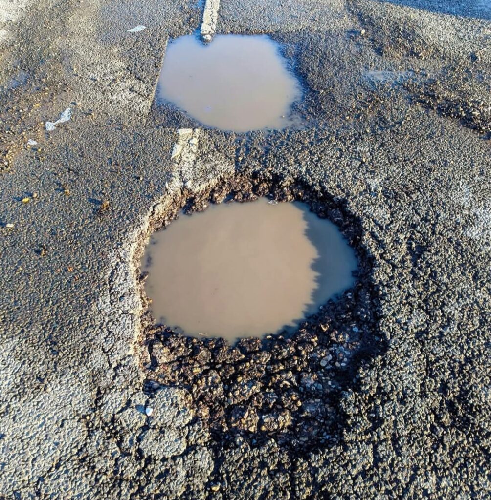
Univrses 3DAI results speak for themselves. In Helsingborg, a Swedish city roughly the size of Portsmouth, the system helped reduce potholes from numbering over 3,000 to around 900 in just six months. Weekly road status checks that previously took 2.5 working days now take one hour. Further, officials estimate they have saved over €17 million in emergency repair costs. While in Stockholm, AI mapped 70% of the city’s road network in just one month, enabling engineers to prioritise repairs based on real-time data and laying the foundations for a road preservation programme expected to halve pothole repair costs and double the lifespan of major roads
In England, National Highways currently use the technology and notably have used it in the past to catalogue 110,000 streetlights across 8,800 kilometres of road in under three months. Previously, this would have been 2,000 night shifts for crews.
The timing is highly relevant for Britain. The government has just committed £7.3 billion to councils across the country to fix their roads. However, councils that fail to demonstrate by September 10th that they are spending this money on substantial, long-term maintenance rather than short-term patching will have nearly a third of their funding retracted. Transparency and evidence are being demanded, highlighting the urgent need for better data.
Polling suggests that the majority of British drivers believe that roads in Britain are the worst in Europe (The Telegraph, 2023), and the reasons are well understood. They are chronic underinvestment, reactive rather than proactive management, and a persistent absence of the kind of real-time data that would allow problems to be caught before they become crises (AIA, 2024; GOV.UK 2024).
The money is now there. The accountability framework is now there. What is needed is the data infrastructure to make both of them actually work.
(Pictures: Univrses/Magnific, formerly Freepik/Lee Hasler)