
UK transport technology companies and project teams are being encouraged to consider how they could put their work in front of an international audience through a giant interactive map at the Intelligent Transport Systems World Congress 2027 at Birmingham’s NEC next October.
The initiative will give participating organisations an opportunity to demonstrate their technology to transport authorities, operators and potential partners from around the world, using real deployments to show what their solutions can achieve.
Organisations will be asked to pitch to contribute, with submission details to follow. Teams are being encouraged to start identifying suitable projects and gathering footage now, where possible including material showing conditions before technology is installed.

The planned 1,200 square metre map of the UK and Ireland will allow delegates to scan QR codes and watch short videos about individual projects. The films will also be available through the Congress website, extending their reach beyond visitors exploring the map at the event.
For companies, the opportunity is to show prospective customers how their technology works in practice, supported by evidence of its impact. For transport authorities and project partners, it offers a platform to demonstrate successful delivery, share learning and build relationships with organisations facing similar challenges.
The map also provides a way to showcase projects which cannot physically be brought to Birmingham. Delegates will be able to explore deployments across the country, seeing the locations, people and transport networks benefiting from UK expertise.
Led by Ordnance Survey, supported by ITS UK and WSP, and working with Technical Advisory Group Chair Andy Graham of White Willow Consulting, the initiative will feature real-world intelligent transport systems deployments and pioneering proof-of-concept projects. It is intended as a showcase rather than an awards scheme or competition.
Contributions will relate to the Congress’s four themes: Trustworthy and Resilient Systems, Next-Generation ITS, Connected and Integrated Services, and Deploying ITS at Scale.
A clear video case study could also give contributors a useful asset for their own communications, customer presentations and future business development, subject to the permissions agreed. Planning filming alongside project delivery can help teams capture useful material as work progresses.
That makes the “before” footage particularly important. Recording existing congestion, infrastructure or operational challenges will help demonstrate why a solution was needed and what changed after its introduction. Once a scheme is complete, the opportunity to capture that starting point may have been lost.
The current plan is to showcase a series of films, each approximately 60–90 seconds long, filmed in landscape format with a 16:9 aspect ratio and High Definition resolution. Each should explain where the project is, the challenge it addresses, how the solution works and who benefits. Short interviews should be supported by footage of the technology operating, with evidence or practical examples demonstrating its impact.
The footage should be supplied without any music, captions, graphics or subtitles. These will be added as required by the project organisers to support consistent “look and feel” of all the videos. Necessary permissions should be secured, with final branding, delivery requirements and deadlines to be confirmed.
Max Sugarman, Chief Executive of ITS UK, said: “The UK is full of projects and people delivering the future of transport and this map will be a fantastic resource to showcase the best of the UK. We encourage everyone to submit videos to be part of this critical demonstration of UK expertise!”
“Location is fundamental to understanding how transport works and the challenges it needs to solve,” added OS Head of Markets, Bradley Taylor. “The interactive map will bring together some fantastic examples of UK transport innovation through place, helping delegates understand not just the technology, but the problem it is solving, where it is making a difference and the benefits it creates for people. It’s about creating a really engaging way to explore what is happening across the UK and connect those stories with a global audience.”
Organisations interested in contributing should start considering which deployment would best demonstrate their expertise, what results they can show and what footage they need to capture now to tell that story to the world.
To apply to be part of the interactive map, click here.
The map will complement the Congress’s Operations Centre zone, which will include a working version of the West Midlands Regional Transport Coordination Centre. Staff, CCTV and live data feeds will demonstrate how the region coordinates its transport network, alongside wider examples of live transport information and digital twin technology.
These will sit alongside the wider international exhibition at ITS World Congress Birmingham 2027, where technology providers, transport authorities and industry leaders can connect face to face. Organisations interested in building on their map contribution can also explore exhibition and partnership opportunities to demonstrate solutions, meet prospective customers and engage with international delegations. Participation in the map does not require booking an exhibition stand. For exhibition and partnership information, see the live floorplan and Congress brochure.
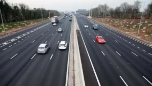
(Picture – OS/Andy Graham)